
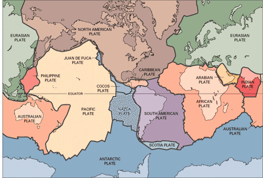
The boundaries and current locations of the Earth’s tectonic plates. Source: United States Geological Survey
Discover related resources in the Understanding Hazards Collection and on the Big Weather page.
The boundaries and current locations of the Earth’s tectonic plates. Source: United States Geological Survey
The Earth’s crust rests on top of a hot, slowly flowing layer of partly melted rock in the Earth’s mantle. This causes the tectonic plates in the crust to move over time.
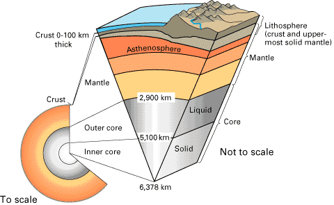
The Earth is made up of layers of rock which surround the core. Source: United States Geological Survey
When tectonic plates move against each other, friction can cause the plates to get stuck, and pressure can slowly build up between them over time. Earthquakes happen when this pressure is suddenly released and the rocks suddenly break or slip along cracks called faults. This energy travels from the epicentre as seismic waves through the crust, causing it to vibrate and shake – what we feel as an earthquake.
The size and intensity of earthquakes are measured using seismometers which record seismic waves. The size of the earthquake is indicated by its magnitude (using the Richter scale). A smaller number (2 or 3) means a small earthquake that people may not feel. A bigger number (6 or 7) means a strong earthquake that can cause damage.
The highest magnitude earthquake ever recorded globally was the Valdivia earthquake in Chile in 1960, with a magnitude of 9.5.
Earthquakes can occur anywhere on the Earth’s surface. However, they are more frequent and severe along tectonic plate boundaries. The Pacific Ring of Fire is a belt of tectonic plate boundaries that surround the Pacific Ocean. 90% of the world’s earthquakes occur along this belt, and it contains 75% of all active volcanoes on Earth.
Countries like Japan, New Zealand and Indonesia experience more frequent earthquakes as they lie close to the boundary of multiple tectonic plates on the Ring of Fire.
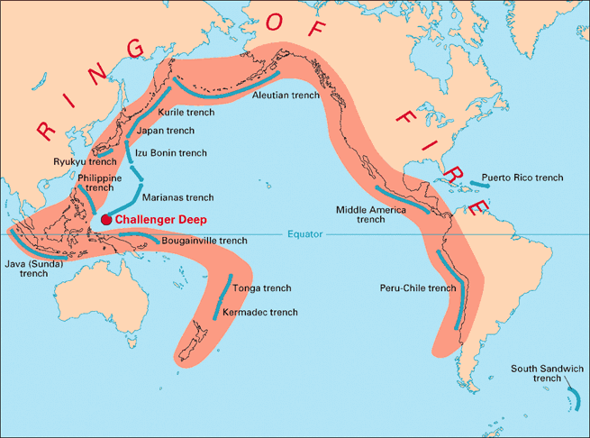
The Pacific Ring of Fire. Source: United States Geological Survey
You can find more information about some of Australia’s largest earthquakes via the interactive Disaster Mapper.
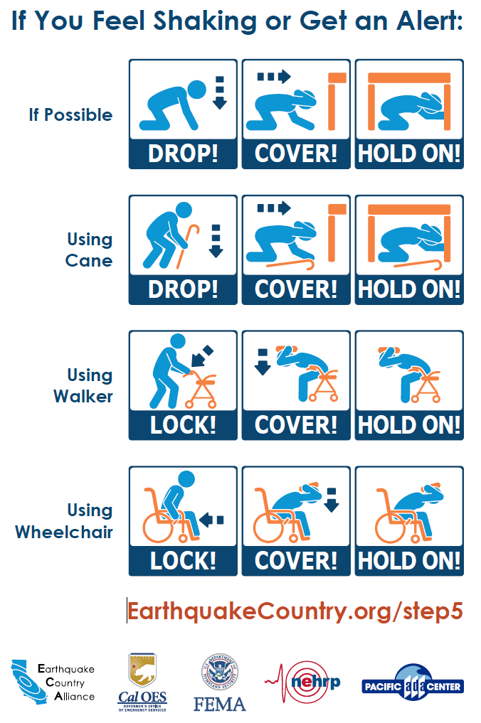
Governments have information about how to stay safe in an earthquake, including dealing with aftershocks.