The provision of relevant information and communication to communities during a high-hazard event remains a consistent challenge for the emergency management sector. While there is diversity of information sources and mechanisms to disseminate content to the public, research indicates there is still an unmet demand for timely, local, highly specific hazard information. Post-disaster surveys conducted following 3 natural hazard events in north Queensland between 2019 and 2024 show that while respondents accessed a wide variety of information sources and were generally satisfied with the quality of information, there were still several perceived gaps. During these hazard events, community members expected to readily access detailed, consistent and localised information to reduce uncertainty and assist decision-making. Telecommunications and power network failures caused by the hazards revealed over reliance on information technology as the primary source of communication for many households. Lessons learnt from such experiences can improve our understanding and practical approaches in future events.
Introduction
The Centre for Disaster Studies (CDS) at James Cook University in North Queensland has over 4 decades of knowledge and experience in providing guidance to emergency managers in areas of community hazard awareness, preparedness and hazard response (CDS 2024). A key to understanding community behaviour during any event has been to conduct post-disaster surveys within a few days or weeks after a disaster has occurred. This research is designed to review experiences at the household level and identify any gaps in knowledge or practice. As public information and communication was identified as a central area of concern in Australia’s Royal Commission into Natural Disaster Arrangements (Commonwealth of Australia 2020) and similar public enquiries (IGEM n.d.), CDS post-event surveys include specific sections about sources of hazard and emergency information, communication as well as advice and support immediately before, during and after the disaster.
In using uniform survey questions over multiple events, post-disaster research is able to identify and report on the sources of information used by the public to enable emergency managers, forecasters and government officials to develop and improve hazard messaging, warnings and support services. Central to both the post-disaster surveys and the feedback to professional stakeholders is community perception, understanding and interpretation of information and warnings. A review of existing literature indicates the increasing complexity in managing prolific information sources for effective hazard communication to affected communities and the value of learning from past events.
This paper draws directly on the experiences of local respondents following 3 natural hazard events of the 2019 monsoonal floods in Townsville, Cyclone Jasper and subsequent floods in Far North Queensland in December 2023 and the effects of Cyclone Kirrily on the Townsville population in January 2024 (see Figure 1).
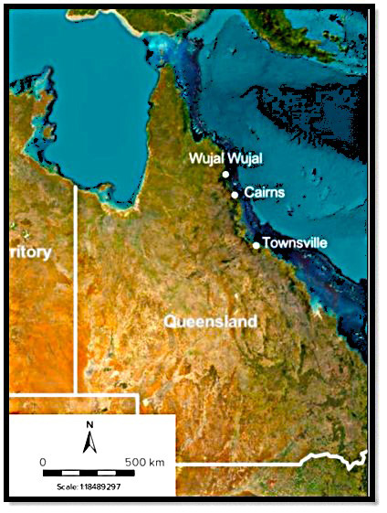
Figure 1: Locations along the Far North Queensland coastline of the monsoon floods and Tropical Cyclone Kirrily (Townsville), Tropical Cyclone Jasper (Wujal Wujal) and associated flooding (Cairns).
Queensland is considered the most disaster-prone state in Australia and such hazard events are not unusual. Field-based observations were used and data were collected and analysed from the online post-disaster surveys targeted at the household level (with minor modifications of words appropriate to the details of the event). A significant emphasis was placed on questions designed to understand people’s needs and use of information and communication from a range of organisations and service providers. Additionally, respondents were provided the opportunity to give open-ended comments on communication flows and problems as well as suggestions on what might be improved in the future. This research methodology proved an effective way to draw out lived experience, variable perspectives and community expectations.
Information and communication themes in the research literature
Contemporary emergency and disaster management literature reveals several common themes regarding the provision of hazard information and communication to the community. While there is some overlap, prevailing issues include the multiple channels of communication; engaging all the community with clear, accessible and tailored messaging; the demand for timely and accurate communication and building trust and transparency. Research clearly indicates it is not just about the provision of information but ensuring that the content is effectively understood, trusted and acted on by all parts of the community.
Technology and multiple information platforms
The first decades of this century reflect a period of information explosion driven by information technology, the internet, social media and an integrated globalised network across societies. Beyond traditional broadcast communication channels such as newspaper (print), radio, television and landline telephones, there is now a multitude of media platforms including smartphones, text messaging and portable, wireless internet access. Additionally, remote sensing technologies and Internet-of-Things devices such as weather sensors, provide real-time data (Krichen et al. 2024). The abundance and availability of so many channels suggests the capacity to provide information across all of society, answering to all and any needs, but the availability is neither geographically nor socially equal. There are gaps in terms of access, which, coupled with a perception that there is additional unstated information out there, means that communities still demand more (Eriksson 2018). The challenge for emergency managers and forecasters has become increasingly complex and difficult as expectations increase to make greater use of technologies to provide precise, timely and accurate information. In an emergency or disaster event this is made acute when people need information about their specific location and understanding. There is a greater urgency and attention during an event that multiplies the demands and responsive actions of the community that want relevant information to decide about preparation, safety and recovery activities.
Proactive and targeted messaging
In appreciating the inherent constraints of existing systems and resources during an event, a common approach has been to increase proactive education, awareness and resilience campaigns and to pre-develop clear, accessible and tailored messaging. Premised on simplicity and cultural sensitivity, emergency managers have focused on tailoring messages to the needs of parts of communities identified as ‘vulnerable’ groups on the basis of characteristics such as linguistic, socio-economic and demographic contexts (Clarke et al. 2024; Maddock 2021; Howard et al. 2017), ethnicity and culture (Eriksson 2018) and gender diversity (King 2022). Such messaging and information are especially important for events that may necessitate evacuation (Turner and Couture 2024; Clarke et al. 2017). Effective hazard-specific evacuation messaging requires targeted demographics, culturally appropriate messages and, in Australia, the responsibilities and jurisdictions of local government councils. A recognised barrier to a targeted approach is accommodating people’s preferences for different communication sources, styles and channels (Perera et al. 2020). Reaching ‘vulnerable’ populations and marginalised groups requires information to be provided in accessible formats and in ways that accommodate those needs.
Engaging local communities in emergency information and communication
As greater quantities and details of information are posted online via websites and through social media, there is a continued need to activate information that is presented in official or static advice formats, through direct communication and social engagement (Clarke et al. 2024; Atkinson 2023). The flow and explanation of information is more important than its static existence however well crafted and targeted it may be. Within communication processes, newer formats and platforms like social media, may not be that different from existing communication and education practices (Eriksson 2018). Beyond passive exposure and incidental knowledge, active learning requires awareness, curiosity and understanding. Even with the proliferation of digital and social media, the essence of good communication (connection and information exchange) remains unchanged. It is the medium through which it occurs that has undergone a revolution (Anuashok et al. 2024). Rather than just being provided information, communities should have the opportunity to ask questions, provide feedback and engage in discussions with authorities. Two-way communication builds trust and understanding (Yell and Duffy 2018; Ogie et al. 2022). Eriksson (2018) argues that emergency managers should prioritise traditional media sources in times of disaster as well as using social media effectively. Purohit et al. (2025) argue that a hybrid approach, combining traditional and social media, is essential for comprehensive and effective emergency communications. Ames and Hewson (2019) advocate use of warnings and weather prediction from both formal and informal/unofficial sources.
In recognising that information generated by the public can be locally based and location-specific, it may lack relevant hazard information at the equivalent scale, despite having detailed knowledge of the local community. Ames and Hewson (2019), Rondeau and Deans (2023), Maddock (2021) and Atkinson (2023) all suggest that there is an increasing demand and expectation from people for detailed hazard information at the local level. To enhance hazard resilience, information and communication must be oriented around the local community. Information is intended to make people safer so it is necessary to engage and empower the active use of information at the community level (Atkinson 2023; Brataas 2018). Maximising the use of community-based knowledge during a hazard event requires leveraging local expertise and trusted networks to disseminate timely, verified information and contest misinformation (Kankanamge et al. 2020).
Establishing credibility and community trust
Building trust and transparency within communities remains integral to effective disaster management (Fakhruddin et al. 2020). Regular, consistent and transparent communication from trusted authorities builds confidence. This is particularly important during the response phase when the community may be anxious or uncertain. Communities are more likely to respond to hazard information when they trust the source (Duckworth 2022). Establishing long-term relationships between authorities and communities is therefore essential for effective communication during events. Hazard communication and messaging should also adapt as the situation evolves. As emergency and disaster contexts are dynamic and often unpredictable, it is important to keep communities updated with the most current information. Credible, relevant, up-to-date and accessible information allows people to make informed decisions.
Risk perception and variable needs
This research suggests that it is equally important to appreciate that not all members of the community perceive and act on information and warning messages in the same way (Fakhruddin et al. 2020). In addition to socio-economic, demographic and cultural diversity, individuals within communities and homogenous groups demonstrate highly variable risk appetites. Scovell et al. (2019) argue the importance of recognising highly variable attitudes and appetites towards risk. They use a scaled range from ‘proactive pessimists’ to ‘deniers’, like the long-used categories of ‘risktakers’ through to ‘risk-averse’ that have been employed by emergency managers. For information, messaging, warnings and communication there is no one-size-fits-all approach. As information technologies expand and proliferate the choices, means of delivery and demands and stresses on communities, as well as emergency managers and forecasters, has become a critical and complex problem.
Research context
As the emergency management sector develops and trials different communication tactics and approaches, direct experience is an opportunity to explore challenges and issues in hazard communication and information. Using 3 disaster-declared events in North and Far North Queensland over a 5-year period, community-based research was conducted to investigate preparedness, personal experiences, hazard effect and access to information and guidance of affected people. Each of the weather events chosen occurred within the tropical Queensland wet season when cyclones, storm surges, floods and rapid inundation are historic hazard risks. As such, communities in these areas are considered to possess high levels of preparation and experience. Using a replicated online survey instrument provided the opportunity to explore any variations in time, in the different hazard contexts and variable affected populations. The Australian Bureau of Meteorology (BoM n.d. a, b) and Queensland Reconstruction Authority (QRA 2024) provide information about these events.
The monsoon flood event 2019
In January to February 2019, extensive heavy rainfall from a monsoonal trough and associated low-pressure system fell over north Queensland. Townsville airport recorded 1,260 mm over 10 days while some areas within the city council area experienced over 2,000 mm. Rivers flooded in the lower Burdekin and Herbert catchments, including the Ross River that crosses the central urban areas (QRA 2024). The Ross River Dam, which functions as flood control and reservoir for the city, reached 248% of its capacity by 5 February. Mitigation processes saw the dam gates opened from 1 February that resulted in flooding of some suburbs downstream and the need for extensive evacuations of residents. Outlying communities also experienced localised flooding. Around 3,300 properties were estimated to have been damaged by floodwaters and 6,500 insurance claims were lodged (AIDR 2019). The event was estimated to cost Townsville residents, businesses and the council $2.5 to 5.2 billion in clean-up and repairs (IGEM 2019).
Tropical Cyclone Jasper 2023
Tropical Cyclone Jasper developed in the northern Coral Sea in early December 2023 and crossed the Queensland coast as a Category 2 system in the vicinity of Wujal Wujal in the evening of 13 December 2023. It progressively weakened over land and stalled for several days as a low-pressure system. Persistent heavy-to-intense rain fell over the north tropical Queensland coast area including river catchments that were already saturated. This resulted in an extraordinary flooding event (BoM n.d. a). Some Far North Queensland communities and localities were completely inundated, which created large-scale isolation, widespread power outages and significant effects to agriculture, animal welfare, small business and tourism (QRA 2024).
Severe Tropical Cyclone Kirrily 2024
Tropical Cyclone Kirrily crossed the Queensland coast approximately 50 km north of Townsville in Far North Queensland as a Category 2 system late on 25 January 2024 (BoM n.d. b). There was minimal damage to homes and buildings but over 65,000 residents experienced power outages, localised flooding and heatwave conditions (QRA 2024). Over the following week, ex-Tropical Cyclone Kirrily generated intermittent gale-force winds and significant rainfall over the tropical coast that isolated inland Queensland towns and homesteads.
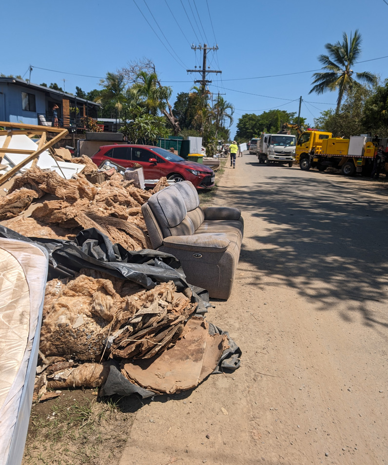
Flood-affected households left damaged contents in streets for council collection.
Image: Yetta Gurtner
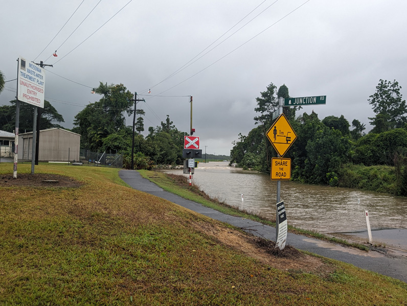
Localised flooding in Mossman, Queensland closed roads and isolated communities.
Image: Yetta Gurtner
Online household survey research method
Surveys have been used by CDS extensively in affected communities throughout Queensland and other locations in Australia, for almost 30 years (CDS 2024). Each survey is modified in relation to the place, time, event and specific issues identified by media and response organisations. However, the primary instrument has become quite standardised. This consistency allows for comparative data collection and identification of any relevant trends or emergent themes.
A mixed-methods research approach was used for each of the events used in this study:
- An online survey with people in affected communities that takes approximately 15 to 30 minutes to complete. Most questions are factual with a very short answer that avoids accounts of stressful situations or requires a selection from suggested responses. Questions allow for open-ended comments. The only personal questions are factual and straightforward and based on Census characteristics.
- Direct observations by researchers of affected locations related to disaster effects collected from emergency management and local government organisations to provide context to resident responses. This is ongoing during the time of the surveys.
Apart from using the results of surveys to analyse community experiences of warnings, preparation and awareness, the researchers also contribute to methodological analysis of post-disaster studies (Cottrell and King 2010; Gurtner et al. 2008).
The online surveys for each event were distributed primarily via local community-based social media groups on Facebook that was supported by localised online and radio promotion. Consistent with previous research, the questions covered the following themes:
- household preparedness (kits, plans, insurance)
- effects of the event and evacuations
- sources of event information and ratings of perceived credibility (and misinformation)
- demographic data.
Initially, a brief introduction, overview of the study and link to the survey was sent to relevant online group administrators requesting permission to distribute the survey. The approved social media post encouraged people to share the link to anyone who may have experienced the event to help improve communication in future events. Established contacts from the Townsville Council community disaster recovery committees were invited via email to promote the survey throughout their networks. Paper-based versions of the survey were available on request and at several local community hubs. None were returned for inclusion. As the intent of the survey was to accurately capture and document lived experiences of disaster events, surveys were posted 2–4 weeks after each event and closed 4 weeks later. As survey responses are anonymous, there is no mechanism to determine if respondents had completed previous surveys.
It is appreciated that online surveys have a responder bias that may exclude portions of the community. In a post-disaster context, online surveys remain one of the simplest and effective mechanisms for broad-based rapid distribution and ease and speed of response. Respondents self-nominate, self-assess and report their experiences without external pressure and are free to withdraw or choose to not submit a response. Given the understanding of how communities access and receive information and communication remains one of the primary purposes of these surveys, data and feedback collected can be used to identify common themes and issues.
Ethics statement
This study received James Cook University Human Ethics approval number H7279 and H9365.
Results
There were 705 responses to the survey received between 15 February and 15 March 2019. This number may reflect the significant and widespread effects of the monsoon flood event. As cyclones Jasper and Kirrily occurred within the 2023–24 tropical monsoon season, those surveys were distributed concurrently and 267 responses were received; 209 relating to Cyclone Kirrily and 58 relating to Cyclone Jasper. The online surveys for both cyclone events were available from late January until 1 March 2024. All 3 surveys took an average of 15 minutes to complete and achieved a completion rate of around 80%. Given that the populations of Cairns and Townsville ranged from 175,000–200,000 at the time of the events, survey response results are considered more informative than statistically representative of those populations.
Household preparedness and event effects
In terms of household preparation, of the survey respondents affected by the 2019 floods, 51% indicated that they were adequately prepared and 65% indicated that they had a disaster kit. In comparison, in the cyclone events, respondents indicated that they felt prepared (over 85% had disaster kits) but that they were not adequately prepared. Associated weather hazards during the cyclones were storm surge, rain, wind, inundation and high humidity. All 3 weather events resulted in widespread power outages but, in the context of Cyclone Kirrily, the excessive humidity and hot weather also led to heatwave conditions. Respondents who experienced power loss reported other issues like lack of sleep, anxiety, fatigue and feelings of isolation.
Excessive heat and humidity without even a fan was almost impossible to withstand. I contemplated booking a hotel just to get a few hour’s sleep. I remember feeling absolutely overwhelmed and helpless and physically and emotionally exhausted.
(Cyclone Kirrily respondent)
Consistent with the monsoon event, flooding and evacuation was a significant issue in some areas with the intense rainfall following Cyclone Jasper. In 2019, only 38% of respondents had an evacuation plan, however, this level had increased to 46–58% of respondents in 2023–24. Few respondents reported that they evacuated during any of these events despite a range of evacuation advice messages being issued. Both voluntary and directed evacuations were issued to local communities, however, many respondents indicated these messages were confusing or were received too late for them to act on.
[I] evacuated due to close proximity to Aplin's Weir. Text messages were vague and ambiguous and other information provided by local government was the same.
(2019 monsoon event respondent)
By the time I realised that the situation described in the emergency warning text applied to me, I could not self-evacuate because the flood waters rose rapidly.
(Cyclone Jasper respondent)
For homes inundated, the effects were highly variable. Respondents reported minor to significant damage to their dwellings and contents, while others lost everything. Many respondents said they were forced to relocate. A Cyclone Jasper respondent said, ‘I was evacuated from my house because it was flooded by over a foot of sewage-contaminated water’.
In contrast to the effects of localised flooding, the lower classification and wind speeds of each cyclone as they crossed the coastline resulted in a loss of power, accumulation of debris and damage to vegetation. As most of this damage was small-scale and minor, public infrastructure and transportation networks were restored to urban centres within a relatively short timeframe. Restoration of these services was delayed in peripheral suburbs and remote communities. Due to extensive infrastructure, network connections and safety considerations, restoration of residential power was variable.
Damage was minimal, fences and trees etc, but the impact of being without power for 6 days and travelling in and out to work during this time had a major impact on our family.
(Cyclone Kirrily respondent)
Reported insurance rates in 2023–24 increased by over 5% compared to 2019 (75% to 83%). Survey open-ended responses showed that many respondents only had contents insurance (i.e. no house or building insurance). While insurance cover for property and possessions is commonly considered as a recovery mechanism, shortfalls in coverage only becomes evident when people make a claim. Being under-insured can reflect unaffordability of insurance premiums and the stress that underinsurance can cause.
Hazard information and communication
A prominent issue identified during the tropical cyclone events was a failure of the telecommunication systems. With increased reliance on and direction to access online information (e.g. via Bureau of Meteorology or local council disaster dashboards) the loss of local mobile and telecommunication connectivity meant that some communities had no access to online communication or information for days; this included text-based alerts. When combined with the loss of power, a number of respondents said that they felt frustration and abandonment.
It would have been ok if people would have understood that once you lose power you lose access to everything but a battery-powered device to listen to the news. All the information on the internet isn't accessible.
(Cyclone Kirrily respondent)
No power for a total or about 4 days, no internet for 5/6 days, flooding to the door of house (not in the house), not able to leave house due to flooding, not wanting to leave the house due to worry, some roof damage, stress and anxiety.
(Cyclone Jasper respondent)
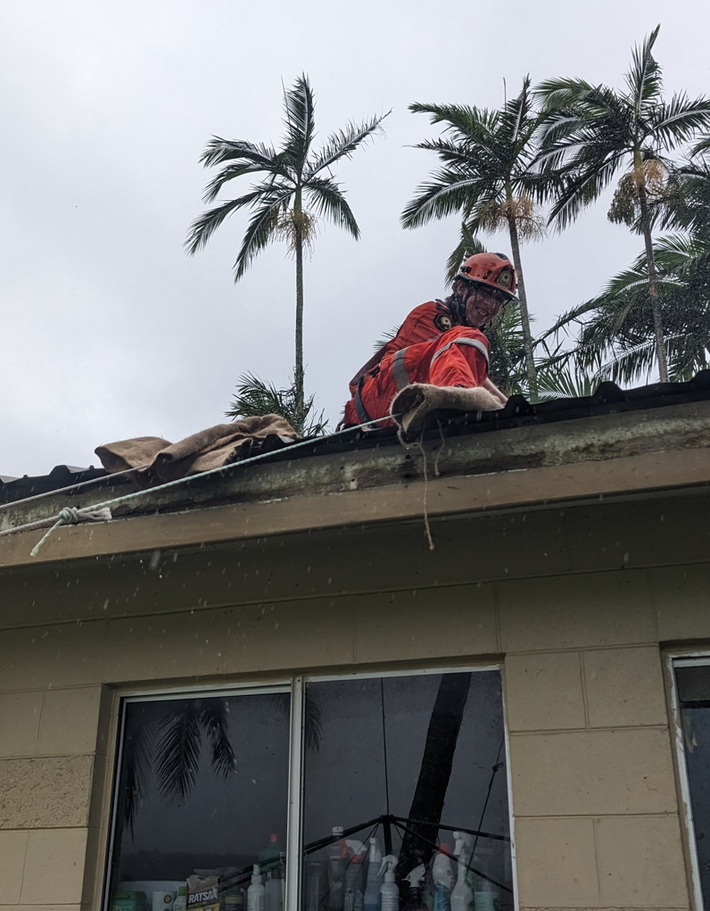
Minor roofing damage caused by high winds during Cyclone Kirrily.
Image: Yetta Gurtner
Given the importance of accuracy and credibility in disaster information, a significant part of the surveys focused on where respondents sourced information from before, during and after the event. The surveys included a range of official authorised sources and other established alternatives and respondents could select more than one answer. While there was a small degree of variation, respondents indicated similar information access patterns for each of the hazard events. Facebook was used more significantly during the 2019 floods. The floods developed relatively slowly and generated uncertainty such that Facebook may have provided reassurance and contact with other friends and family who were anxious about the impending disaster. The survey results showed a trend away from traditional media sources and Facebook, government websites (including Bureau of Meteorology) and the local Disaster Management Dashboard where the main sources of information selected from the survey answer list. Radio rated just above 10% in all events, but the data did not show whether this was throughout the event or after access to power and telecommunications were lost.
Questions in the surveys focused on the different types of information sources. These covered official information sites, Bureau of Meteorology products, other weather-based information sources, media outlets, non-government organisations and community-based groups. After each question, respondents were requested to identify the information sources they personally accessed and to provide a rating on how they perceived the information provided. Each rating was based on 4 categories of ‘accurate’, ‘up to date’, ‘useful’ and ‘trustworthy’. Within each category, respondents could rate information on a Likert scale of ‘completely’, ‘very', 'moderately’, ‘somewhat’, ‘not at all’ and ‘not applicable’. For all sources of information of sites, groups, official, media and informal (i.e. not from an official/authorised source), the majority of responses in all 3 surveys and on all 4 categories of ratings, the highest frequency responses were for ‘very’ and ‘moderately’ ratings. Very few responses were for the ‘somewhat’ and ‘not at all’ ratings.
Table 1: Primary source of information as listed on the survey.*
| Survey question: ‘What was your primary source of information regarding the flood event (you may select more than one option)’. | 2019 floods (%) | Cyclone Jasper (%) | Cyclone Kirrily (%) |
| Television | 7 | 5 | 6 |
| Print media (newspaper) | 0.7 | 1 | 0.6 |
| 26 | 17 | 17 | |
| X/Twitter | 1 | 0.6 | 0.1 |
| 0.2 | 0.6 | 0.5 | |
| Other social media platform (e.g. Flikr, YouTube, blog) | 0.4 | 2 | 4 |
| Media website | 3 | 3 | 4 |
| Government web site (includes Bureau of Meteorology) | 15 | 17 | 20 |
| Local government Disaster Management Dashboard | 16 | 14 | 13 |
| Community website | 2 | 3 | 3 |
| Other Internet source | 1 | 0.6 | 2 |
| Weather-based app (via smart device) | 5 | 7 | 10 |
| Radio | 11 | 12 | 11 |
| Friends/family | 7 | 9 | 6 |
| Telephone support service/hotline | 1 | 2 | 0.3 |
| Other responses | 3 | 7 | 6 |
| Total percentage | 100 | 100 | 1-- |
| Total number of responses | 1,909 | 175 | 161 |
* All numbers above 1% are rounded to nearest whole number.
Open-ended comments provided insight into personal opinions.
Social media was the least accurate when people would speculate on the extent of the information. The silliest people often have the most to say on Facebook, by speaking their thoughts when it is not necessary. Government websites were the most accurate. Bom.gov.au was excellent in monitoring the water levels of the local creeks and rivers, while giving live updates of creek and river water levels several times per hour as required.
(2019 monsoon respondent)
There seemed to be much hype and scare lingering on mainstream media. Govt updates were balanced and helpful. The BoM’s updates need to be more mobile friendly and accessible [using] plain English. Townsville council - recommended crisis support and evacuation centres not applicable to island - as the ferries were down. Police update was useless and after the fact. The local MP used the opportunity to try and score political points rather than help community-based supports were the most useful and trustworthy.
(Cyclone Kirrily respondent)
Survey results showed that the primary reasons people sought hazard information varied depending on the event context. The most common reasons identified in each of the surveys was to access warnings, monitor the event and local impacts, personal preparedness and to track the cyclone or the event. Consistent with the nature and effects of rapid inundation, responses from the 2019 monsoon and Cyclone Jasper showed a desire for information about sandbagging; flood inundation maps; dam, river and waterway levels and evacuations. Information regarding emergency response, recovery, volunteering and donations was sought for more in the more severe events.
Although respondents elaborated in the survey comment sections about finding flaws and recommending improvements to sources of information, respondents were generally satisfied with the information that they received. Overall, respondents indicated that they were very or moderately satisfied with the accuracy, timeliness, usefulness and trustworthiness of information sources. It is important to note that this should not be interpreted as complacency or blanket satisfaction because respondents rated the information they had received. Respondents were able to cite many flaws in some detail as well as occasions of omissions and misleading information.
Perceptions and understanding of information
Each of the post-disaster surveys provided opportunities for respondents to add comments and advice. Question 21, ‘Did you come across any inaccurate, conflicting or misleading information regarding the hazard event?’ resulted in 412, in some cases quite lengthy, responses. These statements were analysed using content analysis and coding for themes and congruence. Given the similarity of themes across the 3 surveys, the comments were collated and are summarised in Figure 2. Word clouds generated from survey data offer a visual representation of information by emphasising the frequency of words or phrases provided by respondents. Word clouds are a simple but effective way to represent large volumes of qualitative data, particularly responses from open-ended questions. The size of the word relative to other words in the word cloud corresponds to how often it appears in responses (its frequency), with words mentioned more often appearing larger. In this way, word clouds show common themes to help identify main concerns, priorities or topics of interest and make it easier to extract insights and understand the responses.
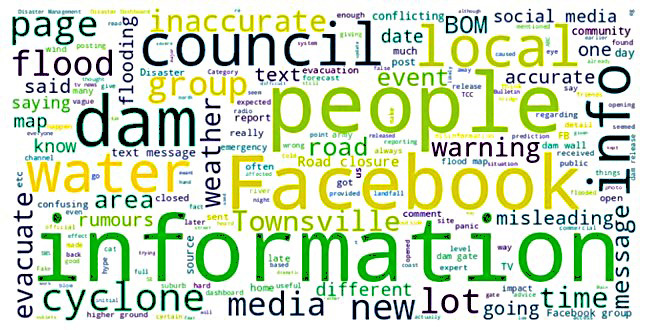
Figure 2: A word cloud of collated open-ended responses to question 21, ‘Did you come across any inaccurate, conflicting or misleading information regarding the flood event?’.
While it is evident from the word cloud for this study that there are discrepancies and issues identified, the majority of respondents left question 21 blank. Similarly, there were many supportive and positive comments provided at other questions. Detailed analysis of the open-ended comments from question 21 particularly showed a lack of local or specific information. Respondents indicated a vagueness or blanket messaging and made criticisms of media information being Brisbane- or southern-centric (i.e. southern Queensland). Respondents also expressed a perceived lack of leadership during the periods of great uncertainty. Facebook was rated highly and also heavily criticised for publishing rumours. In a general sense, but also specifically targeting commercial media and poor information in local newspapers, responses referred to hype, misinformation, hysteria and exaggeration.
The final open-ended question in the surveys requested comments on any aspect of information, warnings or evacuations for the event that could be improved.
Figure 3 word cloud shows a high degree of overlap with themes identified from question such as information, people, council and flood. However, there is an emphasis on warnings and evacuation. From the detailed responses, there appeared to be a consistent lack of understanding regarding the locations and purpose of evacuation centres. Uncertainty also existed related to shelter messages. This was very evident on Magnetic Island (close to the coast at Townsville) during Cyclone Kirrily. Respondents indicated that to help them decide if and when to evacuate, they needed updated flood and storm surge mapping. This was particularly in reference to content that was available on the Townsville Council disaster dashboards. Comment from the survey indicated that flood maps needed to be user-friendly and clearly readable. Some respondents were also critical of urban development that had occurred within flood zones. Evacuation-specific issues such as timing, procedures and inconsistency in warnings and refuge locations indicate a need for improved public information and explanation on these topics. Some respondents felt that evacuation should be compulsory and enforced. The issue of animal and pet evacuation was reported extensively as a barrier to household evacuation. Door knocking to inform residents of evacuation messages was also considered confusing and inconsistent by several respondents.
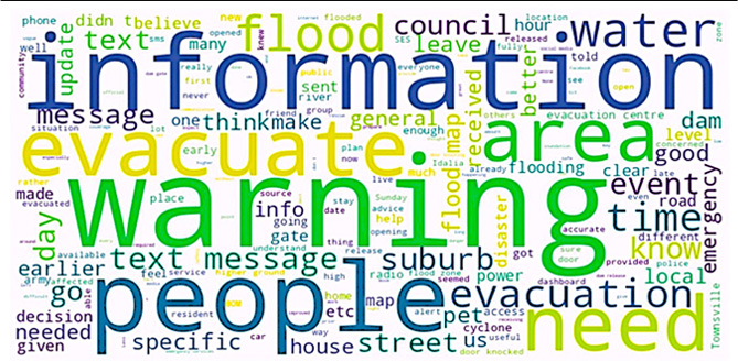
Figure 3: A word cloud of collated open-ended responses to question 29, ‘Please comment on any aspect of information, warnings or evacuations for this event that you believe could be improved’.
Discussion
This survey data are hazard event and context-specific, yet the results add value to the understanding of how people receive and perceive information during a disaster event. Consistent with themes identified in existing literature, survey responses highlight the difficulties of messaging and information consistency when content is of variable quality and available from many sources and platforms. Similarly, there was a strong demand and expectation for more localised, timely and accurate information. Identified issues of misinformation, misunderstanding and miscommunication, credibility and trust continue to be a persistent challenge for effective community-based communication and information before, during and after any emergency event.
Sourcing hazard information
The advance in information technologies and usage since 2000 has presented more choices, more access, more information and more sources of information. Despite this proliferation of resources and content, the greater range has not necessarily improved understanding nor ameliorated uncertainty, risk or threat. During a hazard event, the need for information, advice and guidance is typically more urgent and immediate, yet, with so many sources, there is also a need to evaluate the accuracy and reliability of information for effective decision-making.
While the surveys did not assess technological advances in hazard monitoring nor the methods people use to access information, the data reflects the diversity of information sources used. Established means of information sharing such as traditional media, friends and family were evident, however, many respondents indicated seeking information online and using social media. Although there was a reasonable level of trust and satisfaction of messaging and information, the loss of power and telecommunications for some households reinforced the need to include battery operated AM/FM radios in disaster kits as a redundancy option. Having a variety and choice of information did not necessarily equate to a better understanding or reduced level of uncertainty. The high information load with apparent inconsistencies in content requires a greater degree of time and consideration to evaluate effectively.
Providing the community with local information
Despite the survey results showing an increase in some aspects of preparedness such as disaster kits, evacuation plans and insurance, respondents wanted better communication and information during the event. Because technology is available, respondents wanted, and in many cases expected, information to be specific to their suburb, even to their own property. It was beyond the scope of this research to investigate the value of targeted, tailored messaging without detailed demographic data. However, it was evident that respondents wanted more information that was local, frequent and, underlying these needs, consistent. Posting information on websites is passive. Communication of information needs to be made active by sending it directly to people who need it and, ideally, by enabling those people to respond in some way.
The results showed an aversion to remotely generated, one-sided, commercial and social media hype and there was a clear requirement for localised, relevant, hazard-specific information. Effective messaging and information should endeavour to include local involvement from an established and credible source such as Neighbourhood Watch. Respondents wanted advice and texts to be specific and tailored to their local needs with useful recommendations. This need was evident in each of the hazard events where respondents wanted information about where sandbags and sand were available locally as well as how to effectively sandbag properties against rising waters. Local radio stations were recognised as able to provide this type and level of content, however, improvements were recommended. While elements of Facebook and social media were associated with exaggeration and spreading rumours, survey recommendations were that Facebook pages of governments, councils and organisations must provide regular, accurate and updated information.
Timely, accurate and user-friendly information
Even though the Bureau of Meteorology was held in high regard by respondents, it was also criticised for its variability of predictions, tracking maps, cyclone intensity and, in the case of Cyclone Jasper, a cyclone focus that ignored the consequent flooding. The Bureau’s website content, information provided and tracking maps were criticised as being overly reliant on where the centre line of the cyclone track was and not conceding the high degree of forecast uncertainty. Respondents called for up-to-date information on the potential impact of winds and rain rather than an emphasis on the timing of a cyclone’s centre crossing the coast. It was suggested that the frequency of official information updates should be more frequent, even half hourly.
The Townsville Council disaster dashboards were also criticised for an information time lag. Respondents cited council information shortcomings and found that both flood and storm surge zone maps were confusing. Comments were that official messages need to be clearer, understandable and more mobile friendly. The 2019 monsoon flood information prioritised dam failure. The survey responses identified issues regarding information about road closures (especially related to evacuations) recovery and garbage collection. Specific problems were identified by respondents in smaller or offshore communities.
The word clouds show that there was significant feedback about local warnings and evacuation messaging. Some respondents suggested that these should be issued earlier with stronger advice and recommendations for action. Similarly, responses indicated that doorknocking and sirens could be used to disseminate flood hazard warnings in relevant neighbourhoods rather than sending a generic text. There was high variability in respondent evacuation choices and actions during the flooding events and there was no clear insight into how different respondents understood and evaluated the risks being communicated (Bratas 2018; Rondeau and Deans 2023; Scovell et al. 2019). Apart from safety messages and hazard warnings, greater awareness and understanding are needed about the purposes and locations of refuges and evacuation centres. Given the extent of power loss associated with each event, it was recommended that there are public warnings given in advance about the potential for evacuations.
Establishing trust and credibility
Although relatively satisfied overall, respondents felt that many emergency response agencies provided conflicting, contradictory and misleading information. Specific examples of misinformation were provided, however, the prominence of the Bureau of Meteorology, government websites and local council disaster dashboards as a source of information, suggests a recognition of these as authoritative sources. Respondent opinions were divided about the credibility of established amateur weather forecasters on social media, however, the value was seen in their capacity to convert scientific information into non-technical information and to directly respond to questions from community members. Local radio stations with established media personalities that transmitted from affected locations and who interviewed locals were regarded as more trustworthy than print or commercial TV and radio stations that broadcast from external locations. Respondents indicated that communities seek leadership from official sources and, based on survey comments, generally found this was lacking in each of the events. It is evident that respondents wanted specific information that would directly apply to their situation and circumstances but were faced with an abundance of information that often lacked consistency or accuracy. If an inaccuracy was perceived, respondents lost confidence in the quality and value of the content. A perceived lack of timely, relevant and factual information undermined community trust.
Conclusion
The post-disaster survey data generated from 3 disaster-declared events demonstrate a diversity of hazard communication and information needs. Respondents consistently expressed a desire for more choice, more information, more often. This places a greater pressure on members of the community to sort, balance and act on information from many sources. Misinformation was common. Flaws were also evident in people's perception, understanding and interpretation of information and messages. The fault is not that of emergency managers, forecasters, the media and public servants or the recipients in communities. Rather, there is a continual need to educate, communicate and actively involve stakeholders before and during events. Consistent with the literature, a key finding of this research was the need to maintain simple, clear, consistent, accurate and relevant messaging regardless of the source.
As individuals and households directly affected by these hazard events, the experiences of the respondents give an insight into their community’s levels of resilience. People remain at the centre of all strategies to build resilience. People should also be the focus of messaging and information. Misunderstanding of information may be inevitable and the more information people receive, the more they are required to sort and interpret it. The passive provision of information has to be interpreted and explained to people through a process of education and engagement. Although the findings from this research are specific to the hazard events, it reinforces the challenges and complexity faced by the emergency management sector to prepare, test and provide effective emergency information and communication. Sharing practical lessons and community recommendations from experience will assist the development of future approaches and information products to better safeguard communities.